Updated on 2023/04/13
Route - Greenway of Arrazola
Description
The route starts in the Axpe and Santiago districts, at the crossroads joining both districts. We come across a bus-stop a bare 30m from the starting point. There is a non-adapted information panel at the beginning of the route, which is our starting reference, and is on a barely noticeable downward slope as we head to Atxondo town centre. We come across interesting information regarding cultural, geographical and historical values throughout the route either on panels or posts, none of which are adapted regarding wheelchair access, Braille or QR codes. The route offers benches on the banks of the Arrazola River, rest and/or leisure areas, public WCs and a fountain. Not wheelchair accessible. No access to these places except via the route. At the rest/leisure point, there is the possibility of a bus-stop a mere 30m away with adapted access to the bus-stop. 500m from the end of the route, we can see the town of Atxondo in the background among the numerous forest formations. With 50m left to finish the route we come to a crossroads where the GR 229 continues turning right to finish opposite a bridge, which is our reference point because we have to head to the bridge leaving the GR229 to one side. Once we have crossed the bridge, the route finishes some 15m later. Once inside the town of Atxondo 100m from the route finish line, we find bus-stops on either side of the road.
Highlight
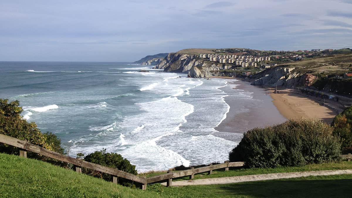
- Landscape Wealth, Urkiola Natural Park
- Green belt, history & culture
- GR 123 section
How to get here
By car:
A8 motorway exit Durango direction Abadiño, Elorrio National Road 634
By bus (Bizkaibus)routes:
A3913 Arrazola-Durango A3923 Elorrio-Durango-Bilbao
A8 motorway exit Durango direction Abadiño, Elorrio National Road 634
By bus (Bizkaibus)routes:
A3913 Arrazola-Durango A3923 Elorrio-Durango-Bilbao
Route
Apatamonasterio-Axpe-Atxondo (Biscay)Section 1
From the Apatamonasterio car park to the Arrazola neighborhood
Suitable for people with reduced mobility (PRM)
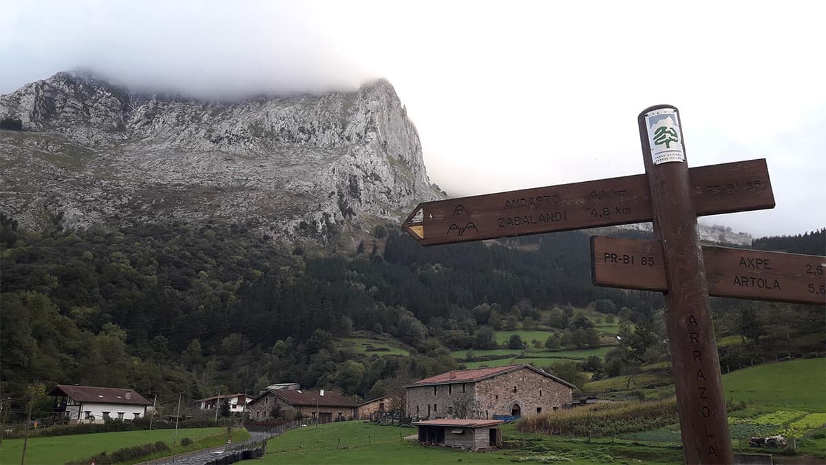
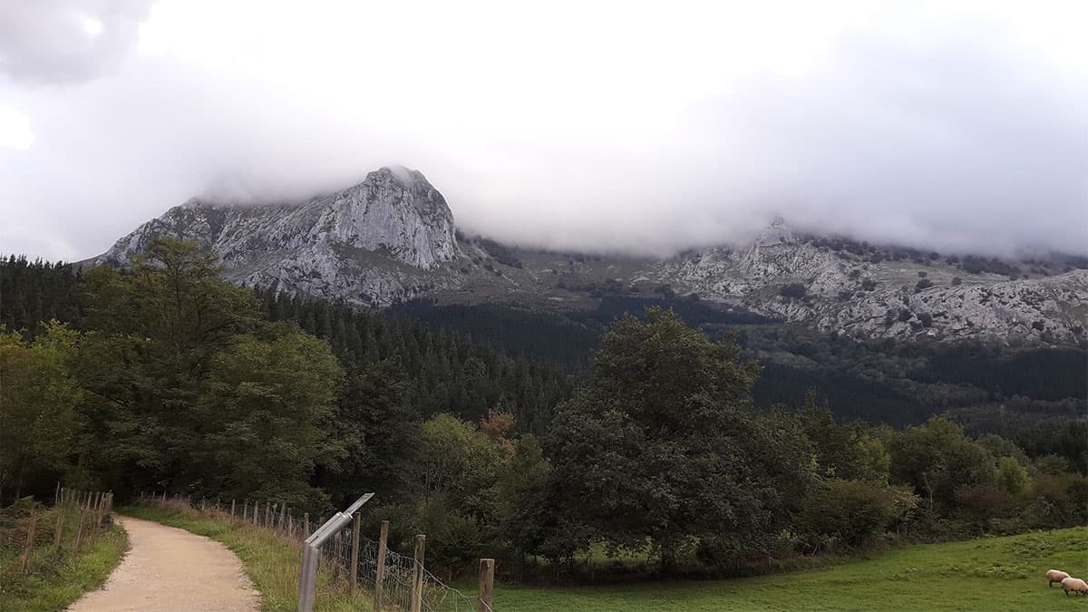
The Arrazola greenway, located in Atxondo, the old path of the Arrazola railway, runs under the slopes of the emblematic Basque Anboto summit, parallel to the Arrazola river, along the spine of the valley of the same name. This route, formerly used for industrial purposes (mining), is a very simple and gratifying route in which the rural environment is the main protagonist.
The Aurrera steam locomotive was in charge of extracting the mineral from the valley to the urban nucleus of Apatamonasterio, located about 5 kilometers away, a fact that is remembered in the final section by means of a wagon in which the mineral was transported. Currently, the environment has been converted into a leisure area, changing the old railway track for a compacted gravel track that is accompanied by green spaces with tables for eating and all kinds of amenities.
Located in the Atxondo valley, in Bizkaia, the Arrazola greenway is one of the most used family plans by Bizkaians, a very recurrent natural resource, which stands out for its views over the Anboto massif (Urkiola Natural Park) and the rural environment that surrounds you. This Basque area is not without its magic. And it is that, Mount Anboto, is the home of Mari, one of the most important mythological beings of our land. Anbotoko Mari, goddess of nature, a mythological being before the Christian religion, was one of the great mystical icons of the Basques, and still is. A character, who together with the akelarres and the sorginak (witches in Basque), makes us immerse ourselves fully in an epic environment, in a magical environment.
(Turismovasco.com)
Description of the section and its accessibility level
- Section length
- 4,57 km
- Pavement
- Compact gravel
- Obstacles
-
- Road crossings without zebra crossings.
- Pivots placed in the middle of the bridge that can hinder the passage with a wheelchair.
Equipment for receiving the external resource on the section
- Is there reception equipment on the section?
- No
Outdoor space: Parking areas and access to equipment
- Are the access slopes suitable for people with reduced mobility?
- No
- Are there railings and/or handrails?
- No
Indoor space: General features
- Are the access slopes suitable for people with reduced mobility?
- No
Personal care area
- Are there personnel trained in accessibility in the facilities?
- No
Rest zone
- Is there a rest area at the reception?
- No
Store
- Is there one or more stores at the reception?
- No
Children’s area
- Is there a children’s area at the reception?
- No
Exhibition room
- Is there an exhibition room at the reception?
- No
Exhibition Hall
- Is there an exhibition hall at the reception?
- No
Interpretive equipment
- Are there trails on the section?
- Yes
Access
- Is there lighting at night?
- No
- Minimum accessible connection between parking spaces, if any, the start of the obstacle-free trail
- Yes
- Is there an adequate slope to allow circulation without assistance, with personal assistance or with technical assistance?
- Yes, without assistance from third parties
- Parking spaces reserved for vehicles used to transport disabled people according to current regulations. At least 5% of the total spaces
- Yes
- Parking signage, if any, with the International Accessibility Symbol on the floor and/or on walls
- Yes
- Informative poster at the start of the trail indicating the length, route, difficulty, duration and slopes by sections
- Yes
- Path start sign positioned no higher than 195cm
- Yes
Itinerary
- Vertical start signage
- Yes
- Vertical signage type
- Read vertical signage
- Compact, non-slip and with no projections along their entire length, allowing wheelchair transit
- Yes. Compacted gravel
- 2 m. paved trails with non-deformable and non-slip material, with a different texture and different from the rest
- No
- For floors with planks, the spacing between the planks is no more than 1 cm, with occasional narrowings of a maximum of 90 cm
- No
- The route is more than 150cm wide, with occasional narrowings of 90cm
- Yes
- Minimum clearance height of 220 cm
- Yes
- Rest areas
- Yes
- Urban furniture (fountains, dispensers...) arranged along the pedestrian route to provide sound orientation
- No
- End vertical signage
- Yes. Final vertical read sign.
- Guiding partition and/or tactile foot signs to draw attention to an important feature
- No
- Islands with a minimum width of 150 cm to facilitate two wheelchairs passing each other
- No
- Is there an adequate slope to allow circulation without assistance, with personal assistance or with technical assistance?
- Yes, with no assistance
- Unevenness through pedestrian routes
- No
- Tree branches do not obstruct the route at below 2.20 m
- Yes
- In botanic gardens, if there are any, Braille signs no higher than 120cm to any accessible communication means
- No
- Route length dimensions and time
- 5km one way Duration of the tour 1 hour and 30 minutes
Cycle touring lane
- Does the section have a cycle touring lane?
- No
Lookout and observatory
- Is there a lookout or observatory on the section?
- No
Educational Facilities
Nature classroom
- Is there a nature classroom on this section?
- No
Recreational facilities
- Is there a recreational area on this section?
- No
Access
- Is there an adequate slope to allow circulation without assistance, with personal assistance or with technical assistance?
- No
Beaches
- Is there a beach on this section?
- No
Reviews
There are still no reviews. What are you waiting for to submit your review?